
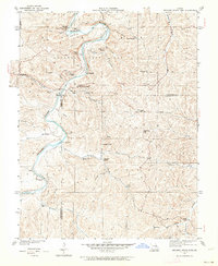
1934 Map of Meramec State Park
USGS Topo · Published 1962About this map
Meramec State Park and the winding Meramec River dominate this landscape, documented in the mid-1930s before the full modernization of the area. This was a critical era of infrastructure development, clearly marked by the presence of a CCC Camp and the Lone Hill Fire Tower. The map details the transition from rural settlements to a recreational destination, featuring landmarks like Meramec Caverns, New Beach, and Fisher Cave. Beyond the park boundaries, the rugged Missouri terrain is dotted with small community centers such as Caseyville and Hamilton, alongside numerous country schools like Pea Ridge Sch and Hamilton Sch. For those tracing local history, the map identifies significant river crossings and landmarks including Hamilton Ford and Sappington Bridge, as well as the numerous springs like Silver Spring and La Jolla Spring that define the Ozark riverways.
Find a feature on this map
46 named features on this map. Tap any name to fly to it.
Don’t see what you’re looking for? This feature index may not catch every label — zoom into the map to look around manually.
Map Details
Editions of this 1934 Meramec State Park Map
2 editions found
Other maps of this area

1901 · De Soto
USGS Topo · 1:125,000

1903 · Sullivan
USGS Topo · 1:125,000

1937 · Meramec State Park
USGS Topo · 1:24,000

1946 · Richwoods
USGS Topo · 1:62,500

1946 · Union
USGS Topo · 1:62,500

1947 · Sullivan
USGS Topo · 1:62,500

1947 · St. Clair
USGS Topo · 1:62,500

1948 · Richwoods
USGS Topo · 1:62,500

1948 · Union
USGS Topo · 1:62,500

1949 · Saint Louis
USGS Topo · 1:250,000