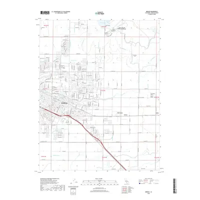
2018 Map of Merced
USGS Topo · Published 2018About this map
Merced dominates this portion of the San Joaquin Valley, showing a sophisticated network of water management through numerous laterals and drains. The city's northern expansion is anchored by Merced College and the sprawling campus of the University of California-Merced near Yosemite Lake. This 2018 survey reveals a landscape where the historic agricultural character of the Central Valley meets modern institutional growth, with the Bnsf railroad corridor cutting through the heart of the settlement.
Find a feature on this map
93 named features on this map. Tap any name to fly to it.
Don’t see what you’re looking for? This feature index may not catch every label — zoom into the map to look around manually.
Map Details
Editions of this 2018 Merced Map
This is the sole edition of this map. No revisions or reprints were ever made.
Other maps of this area

1914 · Merced
USGS Topo · 1:31,680

1916 · Hopeton
USGS Topo · 1:31,680

1917 · Winton
USGS Topo · 1:31,680

1917 · Merced
USGS Topo · 1:31,680

1918 · Lingard
USGS Topo · 1:31,680

1918 · Atwater
USGS Topo · 1:31,680

1918 · Sandy Mush
USGS Topo · 1:31,680

1918 · Planada
USGS Topo · 1:31,680

1919 · Haystack Mountain
USGS Topo · 1:31,680

1919 · Plainsberg
USGS Topo · 1:31,680