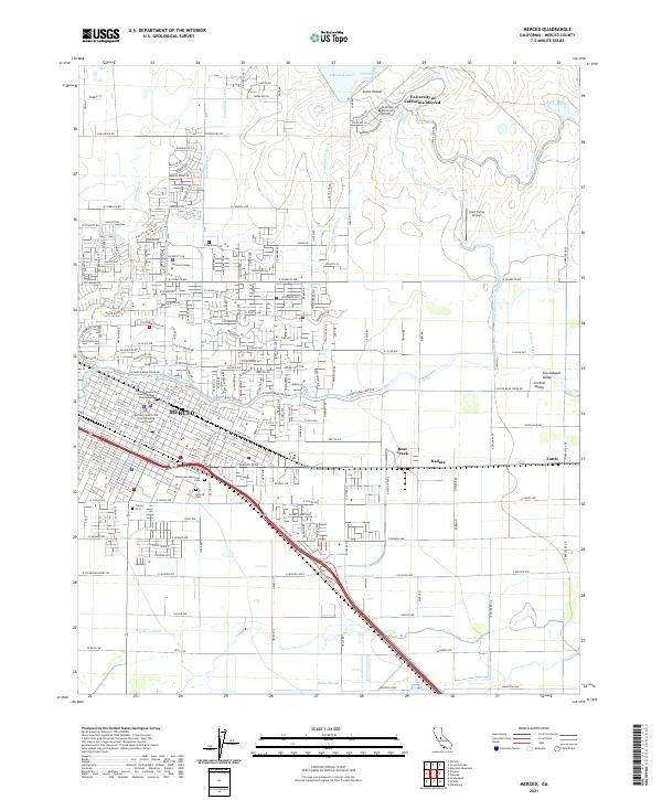
2021 Map of Merced
USGS Topo · Published 2021About this map
Merced stands as a primary hub within the Central Valley, where intricate irrigation systems like the Fairfield Canal, Le Grand Canal, and Yosemite Lateral sustain the agricultural landscape of the San Joaquin Valley. This modern survey illustrates the city’s contemporary expansion, anchored by institutional landmarks such as Merced College and the University of California-Merced near Yosemite Lake. The civic heart of the area is represented by the Merced County 21st Street Building Courthouse and the Merced County N Street Building Courthouse, while the surrounding rural reaches include the settlement of Kadota and the Hunt Farms Airport. A network of cemeteries and parks, including Evergreen Memorial Park and Calvary Cem, provides significant points of interest for genealogists tracing local family histories amidst a backdrop of active watercourses like Bear Creek and Black Rascal Cr.
Find a feature on this map
135 named features on this map. Tap any name to fly to it.
Don’t see what you’re looking for? This feature index may not catch every label — zoom into the map to look around manually.
Map Details
Editions of this 2021 Merced Map
This is the sole edition of this map. No revisions or reprints were ever made.
Other maps of this area

1914 · Merced
USGS Topo · 1:31,680

1916 · Hopeton
USGS Topo · 1:31,680

1917 · Winton
USGS Topo · 1:31,680

1917 · Merced
USGS Topo · 1:31,680

1918 · Lingard
USGS Topo · 1:31,680

1918 · Atwater
USGS Topo · 1:31,680

1918 · Sandy Mush
USGS Topo · 1:31,680

1918 · Planada
USGS Topo · 1:31,680

1919 · Haystack Mountain
USGS Topo · 1:31,680

1919 · Plainsberg
USGS Topo · 1:31,680