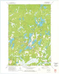
1973 Map of Mercer
USGS Topo · Published 1976About this map
Mercer serves as the central hub of this northern Wisconsin landscape, situated at a major bend in the Chicago and North Western railroad line. The town is surrounded by a dense network of glacial lakes and waterways, including Grand Portage Lake, San Domingo Lake, and Echo Lake. These water bodies are connected by the Turtle River, which winds through the northwestern section of the map. To the east, the Highland State Forest and Iron Co. Forest indicate the heavy timber presence that defined the region’s development.
Find a feature on this map
76 named features on this map. Tap any name to fly to it.
Don’t see what you’re looking for? This feature index may not catch every label — zoom into the map to look around manually.
Map Details
Editions of this 1973 Mercer Map
2 editions found
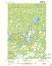
Other maps of this area

1939 · Winchester
USGS Topo · 1:48,000

1940 · Mercer
USGS Topo · 1:48,000

1943 · Ironwood
USGS Topo · 1:48,000

1945 · Mercer
USGS Topo · 1:48,000

1946 · Winchester
USGS Topo · 1:48,000

1947 · Mercer
USGS Topo · 1:48,000

1953 · Ashland
USGS Topo · 1:250,000

1955 · Mercer
USGS Topo · 1:62,500

1955 · Winchester
USGS Topo · 1:62,500

1955 · Wakefield
USGS Topo · 1:62,500