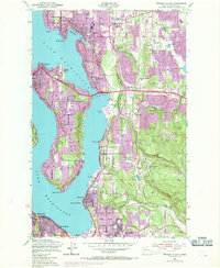
1950 Map of Mercer Island
USGS Topo · Published 1969About this map
Lake Washington surrounds the residential and developing landscapes of the Eastside during a period of significant post-war growth. While Mercer Island City and Bellevue show increasing density, purple revision tints highlight the rapid expansion of suburbs like Newport Hills and Eastgate by the late 1960s. The presence of the Bellevue Airfield and the Northern Pacific railroad line near Wilburton reflects the infrastructure supporting this expansion.
Find a feature on this map
63 named features on this map. Tap any name to fly to it.
Don’t see what you’re looking for? This feature index may not catch every label — zoom into the map to look around manually.
Map Details
Editions of this 1950 Mercer Island Map
4 editions found
Other maps of this area

1894 · Seattle
USGS Topo · 1:62,500

1895 · Snohomish
USGS Topo · 1:125,000

1897 · Tacoma
USGS Topo · 1:125,000

1897 · Seattle
USGS Topo · 1:125,000

1900 · Tacoma
USGS Topo · 1:125,000

1908 · Seattle
USGS Topo · 1:62,500

1909 · Seattle Special
USGS Topo · 1:62,500

1949 · Maple Valley
USGS Topo · 1:24,000

1949 · Renton
USGS Topo · 1:24,000

1949 · Seattle North
USGS Topo · 1:24,000