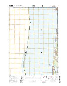
2017 Map of Mercer Lake OE W
USGS Topo · Published 2017About this map
The rugged shoreline north of Florence, Oregon, is defined by the meeting of the Pacific Ocean and the coastal lands of the Siuslaw National Forest. This 2017 study illustrates the delicate balance between the residential enclave of Heceta Beach and the protected habitats of the Oregon Islands National Wildlife Refuge. The map provides a detailed view of the coastal topography where Sutton Creek and the Siuslaw River reach the sea, separated by the narrow transition of Baker Beach.
Find a feature on this map
17 named features on this map. Tap any name to fly to it.
Don’t see what you’re looking for? This feature index may not catch every label — zoom into the map to look around manually.
Map Details
Editions of this 2017 Mercer Lake OE W Map
This is the sole edition of this map. No revisions or reprints were ever made.
Other maps of this area

1920 · Siltcoos Lake
USGS Topo · 1:62,500

1920 · Heceta Head
USGS Topo · 1:62,500

1941 · Siltcoos Lake
USGS Topo · 1:62,500

1942 · Heceta Head
USGS Topo · 1:62,500

1942 · Siltcoos Lake
USGS Topo · 1:62,500

1953 · Salem
USGS Topo · 1:250,000

1954 · Salem
USGS Topo · 1:250,000

1954 · Coos Bay
USGS Topo · 1:250,000
1956 · Heceta Head
USGS Topo · 1:62,500
1956 · Siltcoos Lake
USGS Topo · 1:62,500