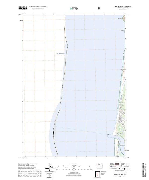
2024 Map of Mercer Lake OE W
USGS Topo · Published 2024About this map
The mouth of the Siuslaw River and the coastal fringes of Florence define this 2024 topographic landscape along the Pacific Ocean. This coastal boundary map showcases the transition from the residential streets of Heceta Beach and the northern edge of Florence to the protected wilderness of the Siuslaw National Forest. The geography is characterized by significant conservation areas, including the Oregon Islands National Wildlife Refuge and the Oregon Islands Wilderness, which protect rocky outcrops such as Cox Rock and the prominent Sea Lion Point. Locally significant landmarks like the South Jetty and the Baker Beach Loop Trl trace the interaction between human infrastructure and the shifting sands of Baker Beach. These features, alongside the course of Sutton Creek, document a modern coastline managed for both recreation and ecological preservation.
Find a feature on this map
29 named features on this map. Tap any name to fly to it.
Don’t see what you’re looking for? This feature index may not catch every label — zoom into the map to look around manually.
Map Details
Editions of this 2024 Mercer Lake OE W Map
This is the sole edition of this map. No revisions or reprints were ever made.
Other maps of this area

1920 · Siltcoos Lake
USGS Topo · 1:62,500

1920 · Heceta Head
USGS Topo · 1:62,500

1941 · Siltcoos Lake
USGS Topo · 1:62,500

1942 · Heceta Head
USGS Topo · 1:62,500

1942 · Siltcoos Lake
USGS Topo · 1:62,500

1953 · Salem
USGS Topo · 1:250,000

1954 · Salem
USGS Topo · 1:250,000

1954 · Coos Bay
USGS Topo · 1:250,000
1956 · Heceta Head
USGS Topo · 1:62,500
1956 · Siltcoos Lake
USGS Topo · 1:62,500