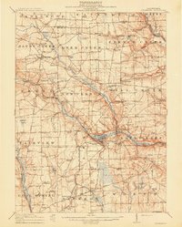
1961 Map of Mercer
USGS Topo · Published 1964About this map
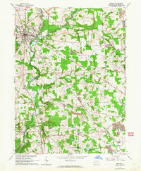
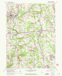
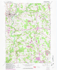
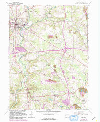
Mercer serves as the focal point of this 1961 survey, where the Pennsylvania Railroad and Bessemer and Lake Erie Railroad converge amidst a landscape transitioning from agriculture to heavy extraction. The town is flanked by essential mid-century infrastructure, including the Waterworks, Sewage Disposal, and a State Sanatorium. To the south and east, the industrial character of the county becomes evident through a network of Gas Wells and significant mining operations like Number Five Mine and various Strip Mines.
Find a feature on this map
53 named features on this map. Tap any name to fly to it.
Don’t see what you’re looking for? This feature index may not catch every label — zoom into the map to look around manually.
Map Details
Editions of this 1961 Mercer Map
4 editions found
Other maps of this area

1905 · Neshannock
USGS Topo · 1:62,500

1907 · Neshannock
USGS Topo · 1:62,500
1908 · Shenango
USGS Topo · 1:62,500
1911 · Stoneboro
USGS Topo · 1:62,500
1913 · Stoneboro
USGS Topo · 1:62,500

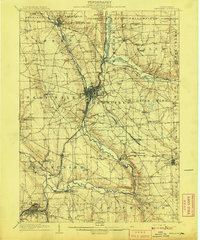
1913 · Mercer
USGS Topo · 1:62,500
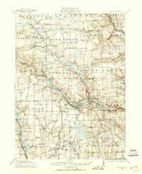
1939 · Mercer
USGS Topo · 1:62,500

1943 · Mercer
USGS Topo · 1:62,500

1943 · Stoneboro
USGS Topo · 1:62,500

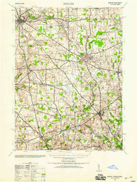
1950 · Cleveland
USGS Topo · 1:250,000
Featured Places
- Mercer, PA
- Findley Township, PA
- East Lackawannock Township, PA
- Amsterdam, Liberty Township
- Wolf Creek Township, PA