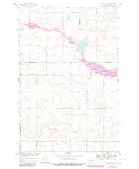
1959 Map of Mercer SW
USGS Topo · Published 1980About this map
Heckers Lake and the Canal system dominate this prairie landscape at the junction of McLean, Sheridan, and Burleigh Counties. The terrain is defined by the distinct townships of Edgemont and Wilson, where a network of rural schoolhouses served the mid-century farming community. These include Park Sch No 2 and several numbered districts like School No 5, providing a clear record of the local educational infrastructure before rural consolidation. The southern portion of the map is marked by the winding course of Painted Woods Creek, while the presence of the Bethel Cem and another local Cem offer specific points of interest for genealogical research. A Gravel Pit near the creek line suggests the small-scale local resource extraction that supported the area's development and road maintenance during this period.
Find a feature on this map
15 named features on this map. Tap any name to fly to it.
Don’t see what you’re looking for? This feature index may not catch every label — zoom into the map to look around manually.
Map Details
Editions of this 1959 Mercer SW Map
2 editions found
Other maps of this area

1949 · Turtle Creek
USGS Topo · 1:62,500

1950 · Wilton
USGS Topo · 1:62,500

1954 · McClusky
USGS Topo · 1:250,000

1958 · McClusky
USGS Topo · 1:250,000

1959 · Pickardville
USGS Topo · 1:24,000

1959 · Mercer
USGS Topo · 1:24,000

1959 · Mercer SW
USGS Topo · 1:24,000

1959 · Mercer SE
USGS Topo · 1:24,000

1961 · Turtle Creek NE
USGS Topo · 1:24,000

1961 · Turtle Creek SE
USGS Topo · 1:24,000