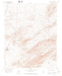
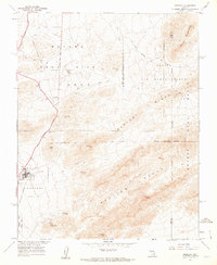
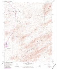
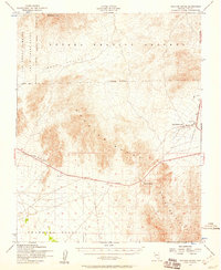
1961 Map of Mercury
USGS Topo · Published 1978About this map
The Nevada Test Site Area 5 and the Nellis Air Force Range dominate this Cold War-era landscape, showing the intensive federal presence in the desert during the early 1960s. At the heart of the activity is the settlement of Mercury, providing housing and services for personnel, including the Deli Frenzi Park and a complex network of underground telephone lines. The terrain is defined by dry watercourses like Sandy Wash and Winding Wash that cut through the Spotted Range and Crossgrain Ridge. Infrastructure supporting the testing operations is visible through several pumping stations and an Eagle Roost Radio Tower. This survey, created in cooperation with the Atomic Energy Commission, documents the intersection of modern military technology and ancient routes like the Old Indian Road, which persists despite the encroachment of the Mercury Highway and various jeep trails.
Find a feature on this map
42 named features on this map. Tap any name to fly to it.
Don’t see what you’re looking for? This feature index may not catch every label — zoom into the map to look around manually.
Map Details
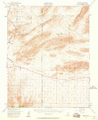
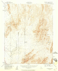
Editions of this 1961 Mercury Map
3 editions found
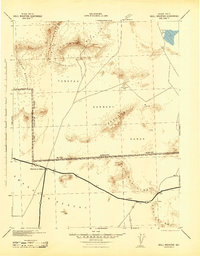
Other maps of this area

1907 · Las Vegas
USGS Topo · 1:250,000

1908 · Furnace Creek
USGS Topo · 1:250,000

1908 · Las Vegas
USGS Topo · 1:250,000

1910 · Furnace Creek
USGS Topo · 1:250,000

1942 · Indian Spring
USGS Topo · 1:125,000
1942 · Skull Mountain
USGS Topo · 1:125,000

1948 · Death Valley
USGS Topo · 1:250,000
1952 · Specter Range
USGS Topo · 1:62,500
1952 · Mercury
USGS Topo · 1:62,500
1952 · Frenchman Lake
USGS Topo · 1:62,500