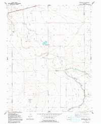
1954 Map of Meredith Hill
USGS Topo · Published 1992About this map
Meredith Hill rises as the prominent topographical landmark in this arid stretch of the High Plains along the Crowley and Otero County line. The landscape is defined by the critical management of water, where the Fort Lyon Canal and Storage Canal cut through the terrain to support local agriculture. The confluence of Horse Creek and Black Draw is managed by the Horse Creek and Black Draw Reservoir, a vital node for the surrounding cattle operations.
Find a feature on this map
16 named features on this map. Tap any name to fly to it.
Don’t see what you’re looking for? This feature index may not catch every label — zoom into the map to look around manually.
Map Details
Editions of this 1954 Meredith Hill Map
2 editions found
Other maps of this area

1891 · Catlin
USGS Topo · 1:125,000

1891 · Las Animas
USGS Topo · 1:125,000

1893 · Las Animas
USGS Topo · 1:125,000

1893 · Catlin
USGS Topo · 1:125,000

1953 · Cheraw
USGS Topo · 1:24,000

1953 · Hadley
USGS Topo · 1:24,000

1954 · Meredith Hill
USGS Topo · 1:24,000

1954 · Sugar City
USGS Topo · 1:24,000

1954 · Lamar
USGS Topo · 1:250,000

1955 · Rocky Ford
USGS Topo · 1:24,000