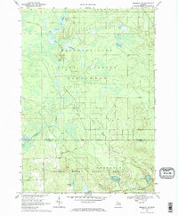
1969 Map of Meredith NW
USGS Topo · Published 1971About this map
Houghton Lake State Forest and its neighbors dominate this landscape in central Michigan, where the geography is defined by a dense network of timberlands and waterways. The map illustrates a transitional period for the land, showing the extensive Old Railroad Grade and Meredith Grade—remnants of the region's logging era—now repurposed or followed by modern infrastructure like the Headquarters Oil and Gas Field Road.
Find a feature on this map
31 named features on this map. Tap any name to fly to it.
Don’t see what you’re looking for? This feature index may not catch every label — zoom into the map to look around manually.
Map Details
Editions of this 1969 Meredith NW Map
2 editions found
Other maps of this area

1954 · Traverse City
USGS Topo · 1:250,000

1956 · Houghton Lake
USGS Topo · 1:62,500

1957 · Harrison
USGS Topo · 1:62,500

1958 · Traverse City
USGS Topo · 1:250,000

1963 · Backus Lake
USGS Topo · 1:24,000

1963 · Prudenville
USGS Topo · 1:24,000

1969 · Meredith NW
USGS Topo · 1:24,000

1969 · Meredith
USGS Topo · 1:24,000

1969 · Meredith SW
USGS Topo · 1:24,000
1969 · Skeels
USGS Topo · 1:24,000