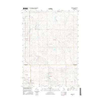
2017 Map of Meredith
USGS Topo · Published 2017About this map
The settlement of Meredith anchors this mid-Michigan landscape where the boundaries of Clare, Gladwin, and Roscommon counties converge. Situated on the southern edge of the sheet, the village is closely tied to the Meredith Cem and the surrounding road network, including Meredith Grade Rd and Evergreen Dr. This terrain is characterized by its complex hydrology, with the headwaters of the Cedar River and the Sugar River draining the forested plains. An intricate system of small lakes, such as Headquarters Lake, Rollway Lake, and Little Headquarters Lake, suggests a landscape shaped by glacial deposits, long used for timber and recreation. Further north, trails like Badger Trl and roads such as Headquarters Rd navigate around isolated water bodies like Young Lake and Doyle Lake, illustrating the rural, wooded character of this multi-county junction.
Find a feature on this map
68 named features on this map. Tap any name to fly to it.
Don’t see what you’re looking for? This feature index may not catch every label — zoom into the map to look around manually.
Map Details
Editions of this 2017 Meredith Map
This is the sole edition of this map. No revisions or reprints were ever made.
Other maps of this area

1954 · Traverse City
USGS Topo · 1:250,000

1958 · Traverse City
USGS Topo · 1:250,000

1963 · Backus Lake
USGS Topo · 1:24,000

1963 · Prudenville
USGS Topo · 1:24,000

1965 · St. Helen
USGS Topo · 1:24,000

1969 · Meredith NW
USGS Topo · 1:24,000

1969 · Meredith
USGS Topo · 1:24,000

1969 · Butman
USGS Topo · 1:24,000

1969 · Wagarville
USGS Topo · 1:24,000

1969 · Meredith SW
USGS Topo · 1:24,000