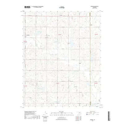
2018 Map of Meridian
USGS Topo · Published 2018About this map
Meridian and the surrounding borderlands of Logan and Lincoln Counties are defined by a network of rural roads and water management sites in this 21st-century Oklahoma survey. The landscape is dotted with several family and community burial grounds, such as Union Hill Cem, Jordan Cem, and the Iowa Mission Cem located in the southeastern corner. These sites, along with small settlements like Iconium and Shiloh, provide essential landmarks for genealogists tracing regional family history near the Indian Meridian line.
Find a feature on this map
67 named features on this map. Tap any name to fly to it.
Don’t see what you’re looking for? This feature index may not catch every label — zoom into the map to look around manually.
Map Details
Editions of this 2018 Meridian Map
This is the sole edition of this map. No revisions or reprints were ever made.
Other maps of this area

1892 · Guthrie
USGS Topo · 1:62,500

1892 · Edmond
USGS Topo · 1:62,500

1909 · Luther
USGS Topo · 1:62,500

1909 · Perkins
USGS Topo · 1:62,500

1935 · Edmond
USGS Topo · 1:48,000

1940 · Edmond
USGS Topo · 1:62,500

1954 · Oklahoma City
USGS Topo · 1:250,000

1957 · Oklahoma City
USGS Topo · 1:250,000

1963 · Oklahoma City
USGS Topo · 1:250,000
1966 · Arcadia
USGS Topo · 1:24,000