
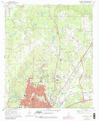
1971 Map of Meridian North
USGS Topo · Published 1973About this map
Meridian anchor the southern portion of this region during a period of significant urban expansion, where residential development pushes north toward Briarwood and Marion. The map reveals a complex institutional landscape, including the State Hospital and various medical facilities like the Nursing Home and Home for the Aged. Numerous small community centers are identified by their local landmarks, such as Oak Grove Ch and Pine Springs Ch, which reflect the area's rural roots amidst the growing suburban footprint.
Find a feature on this map
68 named features on this map. Tap any name to fly to it.
Don’t see what you’re looking for? This feature index may not catch every label — zoom into the map to look around manually.
Map Details
Editions of this 1971 Meridian North Map
2 editions found
Other maps of this area

1921 · Meridian
USGS Topo · 1:48,000

1923 · Meridian
USGS Topo · 1:62,500

1953 · Meridian
USGS Topo · 1:250,000

1957 · Meridian
USGS Topo · 1:250,000

1957 · Chunky
USGS Topo · 1:62,500

1962 · Daleville
USGS Topo · 1:24,000

1962 · Lauderdale
USGS Topo · 1:24,000

1962 · Center Hill
USGS Topo · 1:24,000

1965 · Meridian
USGS Topo · 1:250,000

1971 · Vimville
USGS Topo · 1:24,000