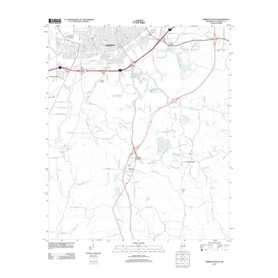
2012 Map of Meridian South
USGS Topo · Published 2012About this map
Meridian dominates the northern portion of this landscape, its urban grid transitioning into the rolling terrain of southern Lauderdale County. Local history is deeply rooted in the numerous burial grounds scattered throughout the area, including the central Rose Hill Cem, the McLemore Cem, and Saint Patricks Cem. The city’s reach extends south through Mount Barton and into more rural settlements like Stinson and Zero.
Find a feature on this map
185 named features on this map. Tap any name to fly to it.
Don’t see what you’re looking for? This feature index may not catch every label — zoom into the map to look around manually.
Map Details
Editions of this 2012 Meridian South Map
This is the sole edition of this map. No revisions or reprints were ever made.
Other maps of this area
1921 · Meridian
USGS Topo · 1:48,000
1923 · Meridian
USGS Topo · 1:62,500

1953 · Meridian
USGS Topo · 1:250,000

1957 · Meridian
USGS Topo · 1:250,000
1957 · Chunky
USGS Topo · 1:62,500
1957 · Quitman
USGS Topo · 1:62,500
1957 · Enterprise
USGS Topo · 1:62,500

1965 · Meridian
USGS Topo · 1:250,000
1971 · Vimville
USGS Topo · 1:24,000
1971 · Meridian South
USGS Topo · 1:24,000