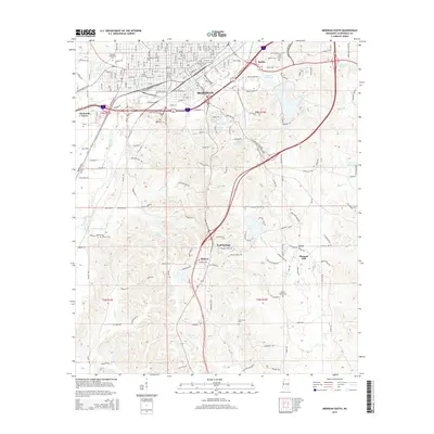
2015 Map of Meridian South
USGS Topo · Published 2015About this map
Meridian spreads across the northern section of this map, transitioning from the dense urban grid of the city center to the rolling woodlands of southern Lauderdale County. The landscape is defined by the winding course of Sowashee Creek and its many tributaries, including Graham-Mill Cr and Gays Branch. Local history is deeply etched into the terrain through a high concentration of family and community burial grounds, such as Rose Hill Cem and McLemore Cem. To the east, the Bonita Reservoir and Webb Lake provide significant water features near the settlement of Bonita. The map also illustrates the importance of regional infrastructure, from the aviation facilities at Key Field to the academic grounds of Meridian Community Coll, alongside outlying communities like Zero and Pleasant Hill.
Find a feature on this map
186 named features on this map. Tap any name to fly to it.
Don’t see what you’re looking for? This feature index may not catch every label — zoom into the map to look around manually.
Map Details
Editions of this 2015 Meridian South Map
This is the sole edition of this map. No revisions or reprints were ever made.
Other maps of this area

1921 · Meridian
USGS Topo · 1:48,000

1923 · Meridian
USGS Topo · 1:62,500

1953 · Meridian
USGS Topo · 1:250,000

1957 · Meridian
USGS Topo · 1:250,000

1957 · Chunky
USGS Topo · 1:62,500

1957 · Quitman
USGS Topo · 1:62,500

1957 · Enterprise
USGS Topo · 1:62,500

1965 · Meridian
USGS Topo · 1:250,000

1971 · Vimville
USGS Topo · 1:24,000

1971 · Meridian South
USGS Topo · 1:24,000