1948 Map of Meridianville
USGS Topo · Published 1964About this map
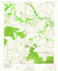
Meridianville serves as a primary junction in this Madison County landscape, where the fertile plains meet the northern reaches of the Cumberland Plateau foothills. The 1948 field examination reveals a community rooted in agriculture and education, anchored by the Alabama Agricultural and Mechanical Institute at Normal. The terrain is defined by prominent elevations such as Wade Mountain and Smith Mountain, which overlook a network of springs and water cress ponds, including the notable Water cress pond near Moores Mill.
Find a feature on this map
55 named features on this map. Tap any name to fly to it.
Don’t see what you’re looking for? This feature index may not catch every label — zoom into the map to look around manually.
Map Details
Editions of this 1948 Meridianville Map
This is the sole edition of this map. No revisions or reprints were ever made.
Other maps of this area

1888 · Scottsboro
USGS Topo · 1:125,000

1888 · Huntsville
USGS Topo · 1:125,000

1892 · Huntsville
USGS Topo · 1:125,000

1892 · Scottsboro
USGS Topo · 1:125,000

1936 · Jeff
USGS Topo · 1:24,000

1936 · Madison
USGS Topo · 1:24,000

1936 · Meridianville
USGS Topo · 1:24,000

1936 · Moontown
USGS Topo · 1:24,000

1936 · Fisk
USGS Topo · 1:24,000

1936 · Toney
USGS Topo · 1:24,000