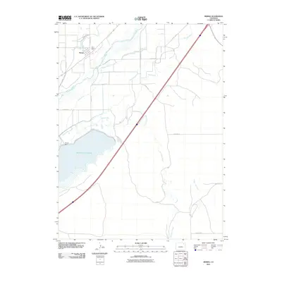
2010 Map of Merino
USGS Topo · Published 2010About this map
The town of Merino serves as the focal point of this 2010 topographic survey, situated at the edge of the South Platte River valley in Logan County. This landscape is defined by its sophisticated agricultural irrigation network, including the South Platte Ditch, Davis Brothers Ditch, and Sand Hill Ditch, which redirect water from the river to sustain the surrounding plains. The presence of the Tom Hoosier Mine near the riverbank points to localized extraction history, while the southern portion of the quadrangle is dominated by the vast Prewitt Reservoir and its associated Prewitt Dam. These man-made features highlight the region's reliance on water management, while natural drainage patterns like the Twentytwo Slough provide a contrast to the geometric precision of the county road grid.
Find a feature on this map
22 named features on this map. Tap any name to fly to it.
Don’t see what you’re looking for? This feature index may not catch every label — zoom into the map to look around manually.
Map Details
Editions of this 2010 Merino Map
This is the sole edition of this map. No revisions or reprints were ever made.
Other maps of this area

1951 · Willard
USGS Topo · 1:24,000

1951 · Messex
USGS Topo · 1:24,000

1951 · Sterling South
USGS Topo · 1:24,000

1951 · Merino SW
USGS Topo · 1:24,000

1951 · Merino SE
USGS Topo · 1:24,000

1951 · Merino
USGS Topo · 1:24,000

1951 · Atwood
USGS Topo · 1:24,000

1954 · Sterling
USGS Topo · 1:250,000

1958 · Sterling
USGS Topo · 1:250,000

1971 · Messex
USGS Topo · 1:24,000