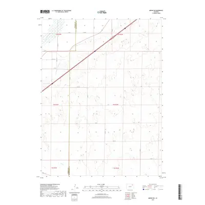
2019 Map of Merino SW
USGS Topo · Published 2019About this map
The South Platte River cuts across the northwestern corner of this landscape, anchoring an agricultural region defined by irrigation infrastructure and county boundaries. The Lower Platte and Beaver Ditch runs parallel to the river, illustrating the critical role of water management in this part of Morgan County. Near the river's bend, Emmerson Lake serves as a prominent local water feature. The terrain is marked by the interface of Morgan and Washington counties, where a grid of rural routes like Co Rd Z provides access to the surrounding plains. The map captures the specialized geometry of the High Plains, where human settlement and water engineering have historically adapted to the natural drainage patterns of the Platte valley.
Find a feature on this map
5 named features on this map. Tap any name to fly to it.
Don’t see what you’re looking for? This feature index may not catch every label — zoom into the map to look around manually.
Map Details
Editions of this 2019 Merino SW Map
This is the sole edition of this map. No revisions or reprints were ever made.
Other maps of this area

1951 · Messex
USGS Topo · 1:24,000

1951 · Antelope Springs
USGS Topo · 1:24,000

1951 · Merino SW
USGS Topo · 1:24,000

1951 · Brush East
USGS Topo · 1:24,000

1951 · Merino SE
USGS Topo · 1:24,000

1951 · Merino
USGS Topo · 1:24,000

1954 · Sterling
USGS Topo · 1:250,000

1958 · Sterling
USGS Topo · 1:250,000

1965 · Miller Ranch
USGS Topo · 1:24,000

1971 · Brush East
USGS Topo · 1:24,000