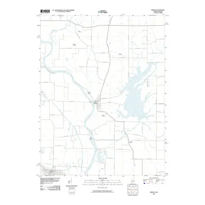
2010 Map of Merom
USGS Topo · Published 2010About this map
Merom Bluff stands as a prominent landmark overlooking the Wabash River, which forms the winding border between Indiana and Illinois. This 2010 survey details the riverside town of Merom and the nearby Palestine Post Office across the water. The landscape is defined by the river’s dynamic movement, evidenced by the creation of Merom Island and Eagle Island, alongside drainage features like Minnow Slough and Turman Creek. For those researching local lineages, the map identifies several distinct burial grounds, including the Old French Cemetery, Mann Cemetery, and Kitchell Cemetery. The presence of the Merom Ferry crossing point highlights a long-standing transportation link between Crawford County and Sullivan County, while the agricultural character of the region is reflected in the expanse of Turman Prairie and the extensive network of county roads.
Find a feature on this map
53 named features on this map. Tap any name to fly to it.
Don’t see what you’re looking for? This feature index may not catch every label — zoom into the map to look around manually.
Map Details
Editions of this 2010 Merom Map
This is the sole edition of this map. No revisions or reprints were ever made.
Other maps of this area

1917 · Birds
USGS Topo · 1:62,500

1942 · Fairbanks
USGS Topo · 1:24,000

1942 · Shelburn
USGS Topo · 1:24,000

1942 · Birds
USGS Topo · 1:62,500

1943 · Merom
USGS Topo · 1:24,000

1943 · Carlisle
USGS Topo · 1:24,000

1943 · Sullivan
USGS Topo · 1:24,000

1952 · Fairbanks
USGS Topo · 1:24,000

1952 · Shelburn
USGS Topo · 1:24,000

1953 · Indianapolis
USGS Topo · 1:250,000