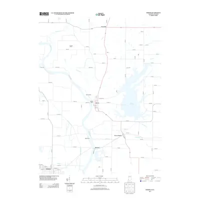
2013 Map of Merom
USGS Topo · Published 2013About this map
The Wabash River carves a winding path through the borderlands of Indiana and Illinois, defining the landscape around Merom. Perched atop Merom Bluff, the town overlooks a broad floodplain containing Merom Island and Eagle Island, where the river's historical shifts have left behind complex drainage patterns like Minnow Slough and Clear Pond Ditch. This 21st-century survey documents a region defined by its water management and transit history, from the high grounds of Turman Prairie to the expansive Turtle Creek Lake in the east. Traces of historical river crossings persist at the Merom Ferry site, while the inland settlement at Merom Station and the town of Riverton show the shift toward overland rail and road networks. Across the state line, the town of Palestine sits near the banks of Sugar Cr, marking the western edge of this riverine corridor.
Find a feature on this map
58 named features on this map. Tap any name to fly to it.
Don’t see what you’re looking for? This feature index may not catch every label — zoom into the map to look around manually.
Map Details
Editions of this 2013 Merom Map
This is the sole edition of this map. No revisions or reprints were ever made.
Other maps of this area

1917 · Birds
USGS Topo · 1:62,500

1942 · Fairbanks
USGS Topo · 1:24,000

1942 · Shelburn
USGS Topo · 1:24,000

1942 · Birds
USGS Topo · 1:62,500

1943 · Merom
USGS Topo · 1:24,000

1943 · Carlisle
USGS Topo · 1:24,000

1943 · Sullivan
USGS Topo · 1:24,000

1952 · Fairbanks
USGS Topo · 1:24,000

1952 · Shelburn
USGS Topo · 1:24,000

1953 · Indianapolis
USGS Topo · 1:250,000