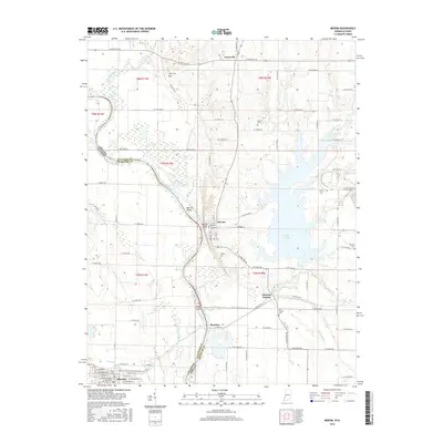
2016 Map of Merom
USGS Topo · Published 2016About this map
The Wabash River forms a winding natural boundary between Illinois and Indiana, defining the geography of this borderland area. On the eastern bluffs, Merom overlooks the river valley, while the lowlands to the west are marked by Minnow Slough and the large alluvial landforms of Merom Island and Eagle Island. This landscape is heavily shaped by water management and drainage, evidenced by Rogers Ditch and the substantial Turtle Creek Lake reservoir to the east.
Find a feature on this map
104 named features on this map. Tap any name to fly to it.
Don’t see what you’re looking for? This feature index may not catch every label — zoom into the map to look around manually.
Map Details
Editions of this 2016 Merom Map
This is the sole edition of this map. No revisions or reprints were ever made.
Other maps of this area

1917 · Birds
USGS Topo · 1:62,500

1942 · Fairbanks
USGS Topo · 1:24,000

1942 · Shelburn
USGS Topo · 1:24,000

1942 · Birds
USGS Topo · 1:62,500

1943 · Merom
USGS Topo · 1:24,000

1943 · Carlisle
USGS Topo · 1:24,000

1943 · Sullivan
USGS Topo · 1:24,000

1952 · Fairbanks
USGS Topo · 1:24,000

1952 · Shelburn
USGS Topo · 1:24,000

1953 · Indianapolis
USGS Topo · 1:250,000