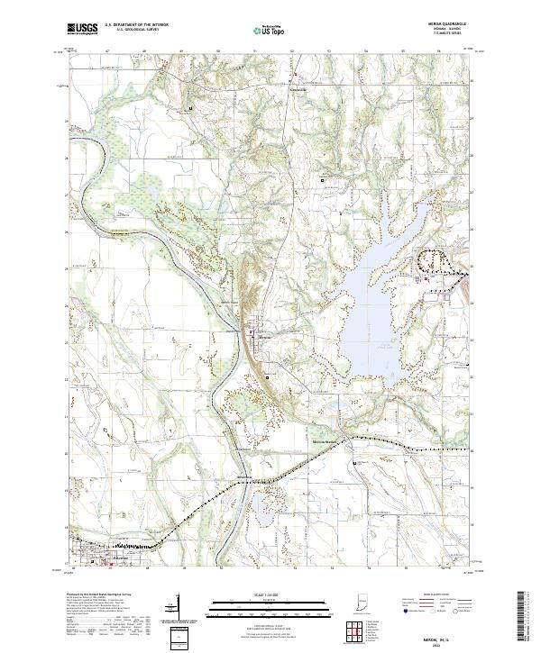
2022 Map of Merom
USGS Topo · Published 2022About this map
Merom Bluff overlooks the wide curves of the Wabash River along the Indiana and Illinois border, a landscape where river navigation once met high-ground settlement. The town of Merom sits atop this vantage point, while the modern footprint of Turtle Creek Lake dominates the eastern portion of the quadrangle. In the surrounding bottoms and uplands, several small burial sites like the Old French Cem and Mann - Turman - Prairie Cem offer significant points of interest for genealogists tracing early families in Sullivan County. The map details the transition from the river-fed wetlands of Minnow Slough and Eagle Island to the structured grid of rural roads and rail-dependent locations like Merom Station. Further west across the river, the settlement of Palestine marks the Illinois side, connected to the larger region by an intricate network of county roads and state routes.
Find a feature on this map
64 named features on this map. Tap any name to fly to it.
Don’t see what you’re looking for? This feature index may not catch every label — zoom into the map to look around manually.
Map Details
Editions of this 2022 Merom Map
This is the sole edition of this map. No revisions or reprints were ever made.
Other maps of this area

1917 · Birds
USGS Topo · 1:62,500

1942 · Fairbanks
USGS Topo · 1:24,000

1942 · Shelburn
USGS Topo · 1:24,000

1942 · Birds
USGS Topo · 1:62,500

1943 · Merom
USGS Topo · 1:24,000

1943 · Carlisle
USGS Topo · 1:24,000

1943 · Sullivan
USGS Topo · 1:24,000

1952 · Fairbanks
USGS Topo · 1:24,000

1952 · Shelburn
USGS Topo · 1:24,000

1953 · Indianapolis
USGS Topo · 1:250,000