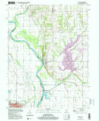
1998 Map of Merom
USGS Topo · Published 2002About this map
The Wabash River serves as the primary geographical divider in this late 20th-century survey, separating Sullivan County, Indiana, from Crawford County, Illinois. Perched on the eastern bluffs, the town of Merom overlooks the river and the broad agricultural lowlands of Merom Island. The landscape is a complex mix of riverine features and rural development, with numerous Gravel Pits and Oil Wells indicating the local industrial footprint. The area's settlement history is documented through several burial grounds, including the Old French Cem and Massey Cem, while the community centers around Graysville and Palestine, the latter situated near the confluence of Sugar Creek.
Find a feature on this map
39 named features on this map. Tap any name to fly to it.
Don’t see what you’re looking for? This feature index may not catch every label — zoom into the map to look around manually.
Map Details
Editions of this 1998 Merom Map
This is the sole edition of this map. No revisions or reprints were ever made.
Other maps of this area

1917 · Birds
USGS Topo · 1:62,500

1942 · Fairbanks
USGS Topo · 1:24,000

1942 · Shelburn
USGS Topo · 1:24,000

1942 · Birds
USGS Topo · 1:62,500

1943 · Merom
USGS Topo · 1:24,000

1943 · Carlisle
USGS Topo · 1:24,000

1943 · Sullivan
USGS Topo · 1:24,000

1952 · Fairbanks
USGS Topo · 1:24,000

1952 · Shelburn
USGS Topo · 1:24,000

1953 · Indianapolis
USGS Topo · 1:250,000