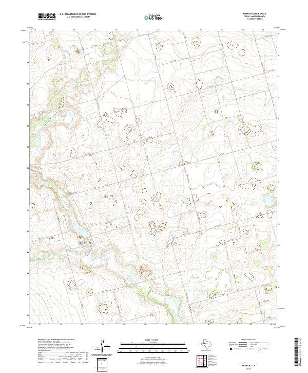
2022 Map of Merrick
USGS Topo · Published 2022About this map
Sulphur Springs Draw meanders across the western portion of this 2022 survey, carving a distinct hydrological pattern through the West Texas landscape. Located in Martin County, this area is defined by its rural grid of agricultural and farm-to-market roads, including the intersection of N Fm 26 and E Fm 26. The map illustrates the contemporary development of rural infrastructure, with a dense network of county roads such as Co Rd 4600 and Co Rd 3800 serving scattered holdings and ranch lands. The topography is subtle, dominated by the drainage system of the draw and numerous small, seasonal water basins. This map provides a clear look at the modern rural layout before significant further changes, showing precisely how Farm Rd 3263-N and Farm Rd 3263-E anchor the local transport system in this part of the county.
Find a feature on this map
28 named features on this map. Tap any name to fly to it.
Don’t see what you’re looking for? This feature index may not catch every label — zoom into the map to look around manually.
Map Details
Editions of this 2022 Merrick Map
This is the sole edition of this map. No revisions or reprints were ever made.
Other maps of this area

1954 · Big Spring
USGS Topo · 1:250,000

1958 · Big Spring
USGS Topo · 1:250,000

1966 · Knott
USGS Topo · 1:24,000

1966 · Merrick
USGS Topo · 1:24,000

1966 · Lenorah West
USGS Topo · 1:24,000

1966 · Flower Grove
USGS Topo · 1:24,000

1966 · Knott SW
USGS Topo · 1:24,000
1966 · Lenorah East
USGS Topo · 1:24,000

1970 · Ackerly
USGS Topo · 1:24,000
1970 · Tenmile
USGS Topo · 1:24,000