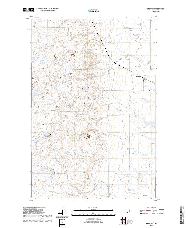
2024 Map of Merricourt
USGS Topo · Published 2024About this map
Merricourt stands as the primary settlement in this section of Dickey County, situated along the intersection of Co Hwy 2 and Manango Merricourt Rd. The landscape is defined by the winding course of the Elm River in the southern reaches and the presence of Wilson Dam to the east. For those researching local heritage, the area contains significant markers such as the Merricourt Cem and the Whitestone Hill State Historic Site Cem located further west. A grid of section roads, including 78th Ave SE and 84th St SE, organizes the rolling prairie, illustrating the enduring agricultural structure of the North Dakota plains. The map provides a precise look at the township and range boundaries that have governed land ownership since the region's early development.
Find a feature on this map
26 named features on this map. Tap any name to fly to it.
Don’t see what you’re looking for? This feature index may not catch every label — zoom into the map to look around manually.
Map Details
Editions of this 2024 Merricourt Map
This is the sole edition of this map. No revisions or reprints were ever made.
Other maps of this area

1894 · Monango
USGS Topo · 1:62,500

1896 · Edgeley
USGS Topo · 1:125,000

1925 · Edgeley
USGS Topo · 1:125,000

1953 · Jamestown
USGS Topo · 1:250,000

1956 · Jamestown
USGS Topo · 1:250,000
1971 · Merricourt SE
USGS Topo · 1:24,000

1971 · Merricourt
USGS Topo · 1:24,000

1971 · Merricourt NW
USGS Topo · 1:24,000
1971 · Merricourt SW
USGS Topo · 1:24,000
1982 · Monango NW
USGS Topo · 1:24,000