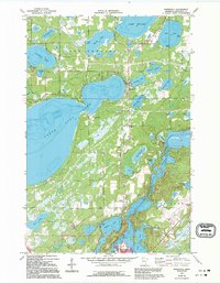
1973 Map of Merrifield
USGS Topo · Published 1995About this map
Mississippi River waters wind through the southern portion of this Crow Wing County landscape, serving as a backdrop for the transition from the lakeside community of Merrifield to the northern outskirts of Brainerd. The geography is defined by an intricate network of water bodies, including the massive North Long Lake and Lake Edward, which reflect the region's long-standing draw for recreation and seasonal residency. The presence of numerous Gravel Pits and Gravel Pits suggest the area's geological past and mid-century industrial utility, while the Brainerd-Crow Wing Airport and several Radio Towers indicate the post-war modernization of the local infrastructure. Genealogists and local historians can locate established burial grounds such as Lake Edward Cem and Evergreen Memorial Gardens, alongside small settlements like Whiteley and Legionville.
Find a feature on this map
43 named features on this map. Tap any name to fly to it.
Don’t see what you’re looking for? This feature index may not catch every label — zoom into the map to look around manually.
Map Details
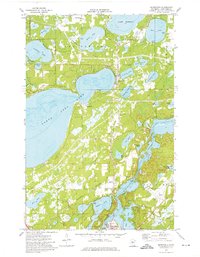
Editions of this 1973 Merrifield Map
2 editions found
Other maps of this area

1915 · Brainerd
USGS Topo · 1:62,500

1916 · Pillager
USGS Topo · 1:62,500

1918 · Brainerd
USGS Topo · 1:62,500

1919 · Pillager
USGS Topo · 1:62,500

1953 · Brainerd
USGS Topo · 1:250,000

1954 · Baxter
USGS Topo · 1:24,000

1957 · Brainerd
USGS Topo · 1:250,000

1958 · Brainerd
USGS Topo · 1:250,000

1959 · Trommald
USGS Topo · 1:24,000

1959 · Pelican Lake
USGS Topo · 1:24,000