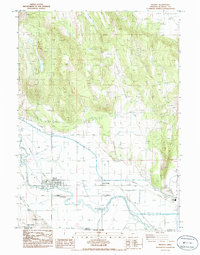
1986 Map of Merrill
USGS Topo · Published 1986About this map
Merrill serves as the focal point of this agricultural and hydraulic landscape, where the Lost River winds through the basin near the California border. The mid-1980s infrastructure reveals a sophisticated water management system designed for the arid high desert, featuring the Anderson Rose Diversion Dam and a Lost River Siphon under River. These engineered features, alongside numerous canals and levees, highlight the transformation of the region's hydrology to support local farming and the Lower Klamath National Wildlife Refuge.
Find a feature on this map
28 named features on this map. Tap any name to fly to it.
Don’t see what you’re looking for? This feature index may not catch every label — zoom into the map to look around manually.
Map Details
Editions of this 1986 Merrill Map
This is the sole edition of this map. No revisions or reprints were ever made.
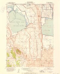
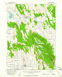
Other maps of this area

1886 · Modoc Lava Bed
USGS Topo · 1:250,000

1889 · Klamath
USGS Topo · 1:250,000

1892 · Modoc Lava-Bed
USGS Topo · 1:250,000

1894 · Klamath
USGS Topo · 1:250,000
1950 · Mt. Dome
USGS Topo · 1:62,500

1951 · Tulelake
USGS Topo · 1:62,500

1954 · Alturas
USGS Topo · 1:250,000

1955 · Klamath Falls
USGS Topo · 1:250,000
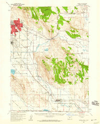
1957 · Merrill
USGS Topo · 1:62,500
1957 · Malin
USGS Topo · 1:62,500