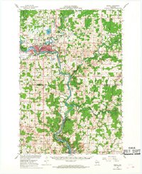
1966 Map of Merrill
USGS Topo · Published 1968About this map
The Wisconsin River dominates this mid-1960s landscape, winding past the regional hub of Merrill and south through the industrial corridor of Brokaw. Near the city, Council Grounds State Park and Alexander Lake mark significant recreational landmarks, while the river's power is managed by several Gaging Stations. The confluence of the Pine River and Prairie River illustrates the importance of the waterways for both transport and utility during this period, supported by the Chicago and North Western and Milwaukee Road railways. Rural life in Lincoln and Marathon Counties is well-documented through small settlements like Taegesville and the industrial activity at Granite Heights. Numerous local institutions, such as St Paul Sch and the Maple Grove Cem, provide essential details for genealogists and local historians tracing family roots in the township of Maine and beyond.
Find a feature on this map
75 named features on this map. Tap any name to fly to it.
Don’t see what you’re looking for? This feature index may not catch every label — zoom into the map to look around manually.
Map Details
Editions of this 1966 Merrill Map
2 editions found
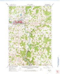
Other maps of this area

1899 · Wausau
USGS Topo · 1:125,000

1902 · Wausau
USGS Topo · 1:125,000

1902 · Marathon
USGS Topo · 1:125,000

1940 · Parrish
USGS Topo · 1:48,000

1950 · Parrish
USGS Topo · 1:48,000

1950 · Tomahawk
USGS Topo · 1:48,000

1950 · Spirit Falls
USGS Topo · 1:48,000

1951 · Doering
USGS Topo · 1:48,000

1951 · Merrill
USGS Topo · 1:48,000

1951 · Hamburg
USGS Topo · 1:48,000