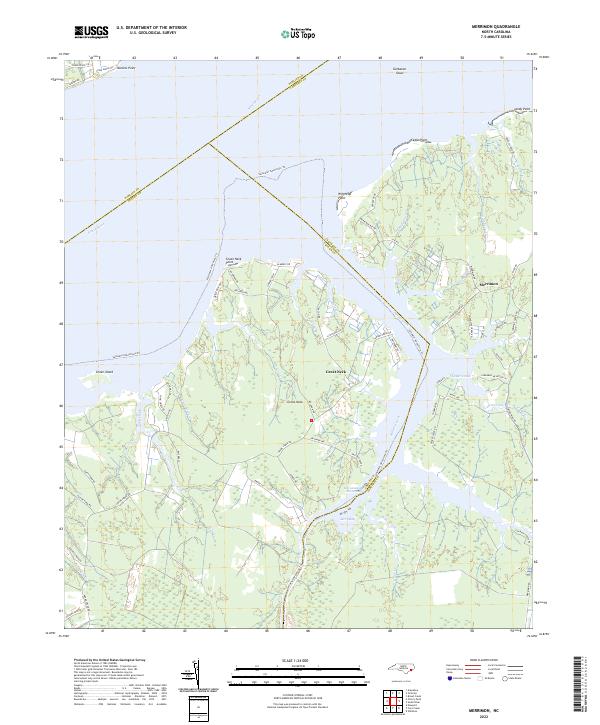
2022 Map of Merrimon
USGS Topo · Published 2022About this map
Merrimon and the surrounding peninsula of Great Neck are defined by an intricate network of tidal creeks and marshes where the Neuse River meets the Intracoastal Waterway. This 2022 survey illustrates a landscape deeply integrated with the water, showing the convergence of Pamlico Co Pamlico Co, Craven Co Craven Co, and Carteret Co Carteret Co boundaries across open water and wetlands. The geography is marked by historic points such as Winthrop Point and Daniels Point, while the interior shows the modern residential footprint along roads like Merrimon Rd and Adams Creek Rd. The presence of the Saltwater Adventure Trail highlights the area's contemporary role as a passage for coastal recreation, even as traditional landmarks like Garbacon Shoal and Jerry Bay remain central to the maritime character of the region.
Find a feature on this map
76 named features on this map. Tap any name to fly to it.
Don’t see what you’re looking for? This feature index may not catch every label — zoom into the map to look around manually.
Map Details
Editions of this 2022 Merrimon Map
This is the sole edition of this map. No revisions or reprints were ever made.
Other maps of this area

1948 · Oriental
USGS Topo · 1:24,000

1949 · Merrimon
USGS Topo · 1:24,000

1949 · Newport
USGS Topo · 1:24,000

1949 · Williston
USGS Topo · 1:24,000

1949 · South River
USGS Topo · 1:24,000

1949 · Cherry Point
USGS Topo · 1:24,000

1949 · Core Creek
USGS Topo · 1:24,000

1950 · South River
USGS Topo · 1:24,000

1950 · Arapahoe
USGS Topo · 1:24,000

1951 · Williston
USGS Topo · 1:24,000