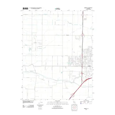
2012 Map of Merritt
USGS Topo · Published 2012About this map
Agricultural lands and water management systems define this portion of the Sacramento Valley, where the city of Davis expands toward the educational and aviation hubs to its west. The landscape is a network of engineered waterways, including the Willow Canal, Moore Canal, and Yolo Central Canal, which support the surrounding farm tracts. Significant drainage features like Willow Slough and Dry Slough meander across the terrain, illustrating the historical hydrologic patterns of the basin. Aviation infrastructure is prominent with both University Airport and Yolo County Airport serving the region. Near the modern residential developments of Davis, the artificial Stonegate Lake and the Davis Golf Course mark the transition from urban to rural use. To the north, the small settlement of Merritt sits near the Elston Spur railroad line, while the community of Plainfield occupies a central position among the grid of county roads.
Find a feature on this map
110 named features on this map. Tap any name to fly to it.
Don’t see what you’re looking for? This feature index may not catch every label — zoom into the map to look around manually.
Map Details
Editions of this 2012 Merritt Map
This is the sole edition of this map. No revisions or reprints were ever made.
Other maps of this area

1907 · Woodland
USGS Topo · 1:62,500

1907 · Davisville
USGS Topo · 1:62,500

1908 · Vacaville
USGS Topo · 1:62,500

1908 · Courtland
USGS Topo · 1:62,500

1915 · Yolo
USGS Topo · 1:31,680

1915 · Swingle
USGS Topo · 1:31,680

1915 · Merritt
USGS Topo · 1:31,680

1916 · Dixon
USGS Topo · 1:31,680

1916 · Grays Bend
USGS Topo · 1:31,680

1916 · Jacobs Corner
USGS Topo · 1:31,680