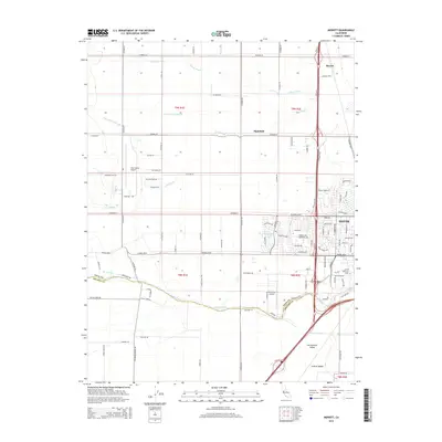
2015 Map of Merritt
USGS Topo · Published 2015About this map
The city of Davis and the expansive campus of the Univ of California Davis anchor the southeastern portion of this landscape within the Sacramento Valley. This survey captures the agricultural and institutional character of the Central Valley just south of Merritt and west of the city center. The terrain is defined by a complex network of irrigation and drainage, including the Yolo Central Canal, Willow Slough, and Dry Slough, which weave through the gridded county roads. To the west, the Yolo County Airport and University Airport serve the region's aviation needs. The southern boundary is marked by the course of Putah Creek, which separates Yolo County from Solano County. Residential developments like those near Stonegate Lake contrast with the large rural tracts and named thoroughfares such as Sparks Ranch Rd and Stevenson Bridge Rd.
Find a feature on this map
102 named features on this map. Tap any name to fly to it.
Don’t see what you’re looking for? This feature index may not catch every label — zoom into the map to look around manually.
Map Details
Editions of this 2015 Merritt Map
This is the sole edition of this map. No revisions or reprints were ever made.
Other maps of this area

1907 · Woodland
USGS Topo · 1:62,500

1907 · Davisville
USGS Topo · 1:62,500

1908 · Vacaville
USGS Topo · 1:62,500

1908 · Courtland
USGS Topo · 1:62,500

1915 · Yolo
USGS Topo · 1:31,680

1915 · Swingle
USGS Topo · 1:31,680

1915 · Merritt
USGS Topo · 1:31,680

1916 · Dixon
USGS Topo · 1:31,680

1916 · Grays Bend
USGS Topo · 1:31,680

1916 · Jacobs Corner
USGS Topo · 1:31,680