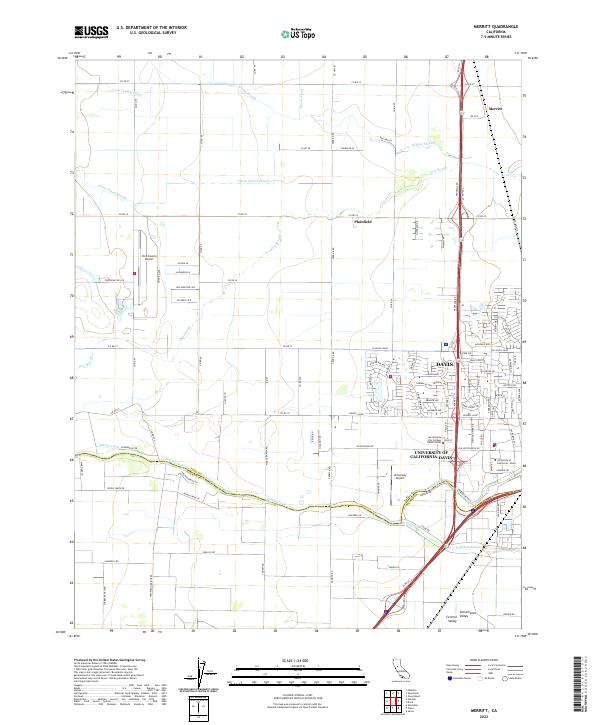
2022 Map of Merritt
USGS Topo · Published 2022About this map
The agricultural and academic landscape of the Sacramento Valley is defined here by the extensive campus of the University of California-Davis and the city of Davis. This area is heavily influenced by a complex network of irrigation and drainage, including the Yolo Central Canal and Willow Slough. The rural-urban interface is stark, transitioning from the structured street grids of the Sacramento City College Davis Center vicinity to the wide-open farm tracts of the northern interior. Transportation hubs like the Yolo County Airport and University Airport serve the region, while the southern boundary is marked by the riparian corridors of Putah Creek and the S Fork Putah Cr. Small settlements such as Merritt and Plainfield provide evidence of early agricultural centers that persisted as the university and city expanded.
Find a feature on this map
115 named features on this map. Tap any name to fly to it.
Don’t see what you’re looking for? This feature index may not catch every label — zoom into the map to look around manually.
Map Details
Editions of this 2022 Merritt Map
This is the sole edition of this map. No revisions or reprints were ever made.
Other maps of this area

1907 · Woodland
USGS Topo · 1:62,500

1907 · Davisville
USGS Topo · 1:62,500

1908 · Vacaville
USGS Topo · 1:62,500

1908 · Courtland
USGS Topo · 1:62,500

1915 · Yolo
USGS Topo · 1:31,680

1915 · Swingle
USGS Topo · 1:31,680

1915 · Merritt
USGS Topo · 1:31,680

1916 · Dixon
USGS Topo · 1:31,680

1916 · Grays Bend
USGS Topo · 1:31,680

1916 · Jacobs Corner
USGS Topo · 1:31,680