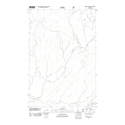
2011 Map of Merry Creek
USGS Topo · Published 2011About this map
The Middle Fork Saint Maries River defines the southern boundary of this high-country landscape, where a complex network of forestry roads and remote drainages converge. In the early 21st century, this region in Shoshone County remains characterized by its rugged topography, anchored by Swan Peak in the northeast and significant transit points like Davies Pass and Hobo Pass. The Merry Creek drainage system, including the West Fork Merry Creek and Ashenfelter Creek, dominates the central terrain. These waterways are mirrored by numerous named creeks such as Two Bit Creek, Flewsie Creek, and Gramp Creek, which illustrate the density of the local watershed. Recreational and logistical access is noted via the Merry Creek Access Area, while the St Joe NFD 301 provides a primary route along the river valley floor.
Find a feature on this map
35 named features on this map. Tap any name to fly to it.
Don’t see what you’re looking for? This feature index may not catch every label — zoom into the map to look around manually.
Map Details
Editions of this 2011 Merry Creek Map
This is the sole edition of this map. No revisions or reprints were ever made.
Other maps of this area

1955 · Pullman
USGS Topo · 1:250,000

1955 · Spokane
USGS Topo · 1:250,000

1958 · Spokane
USGS Topo · 1:250,000

1958 · Pullman
USGS Topo · 1:250,000

1961 · Fernwood
USGS Topo · 1:62,500

1961 · Bovill
USGS Topo · 1:62,500

1969 · Marble Mountain
USGS Topo · 1:24,000

1969 · Anthony Peak
USGS Topo · 1:24,000

1969 · Grandmother Mtn
USGS Topo · 1:24,000
1969 · Grice Ridge
USGS Topo · 1:24,000