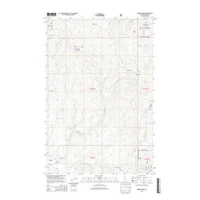
2013 Map of Merry Creek
USGS Topo · Published 2013About this map
Middle Fork Saint Maries River and its numerous tributaries define this mountain landscape within the St Joe National Forest. The settlement of Clarkia is situated near the Merry Creek Access Area, providing a point of entry into the timbered drainage basins of Merry Creek and Bussell Creek. The map documents a complex system of forestry and access roads, including the Round Top Freezeout Rd and Cranberry Creek Rd, which navigate the steep elevations between Swan Peak and Davies Pass. One of the most intriguing features is The Incline in the northern sections of the forest, likely representing a legacy of early timber transport or mining operations. This survey illustrates the 21st-century management of the Idaho panhandle, showing how industrial and recreational access routes like NFD Road 321 have integrated with the natural drainages of Ashenfelter Creek and Corbett Creek.
Find a feature on this map
42 named features on this map. Tap any name to fly to it.
Don’t see what you’re looking for? This feature index may not catch every label — zoom into the map to look around manually.
Map Details
Editions of this 2013 Merry Creek Map
This is the sole edition of this map. No revisions or reprints were ever made.
Other maps of this area

1955 · Pullman
USGS Topo · 1:250,000

1955 · Spokane
USGS Topo · 1:250,000

1958 · Spokane
USGS Topo · 1:250,000

1958 · Pullman
USGS Topo · 1:250,000

1961 · Fernwood
USGS Topo · 1:62,500

1961 · Bovill
USGS Topo · 1:62,500

1969 · Marble Mountain
USGS Topo · 1:24,000

1969 · Anthony Peak
USGS Topo · 1:24,000

1969 · Grandmother Mtn
USGS Topo · 1:24,000
1969 · Grice Ridge
USGS Topo · 1:24,000