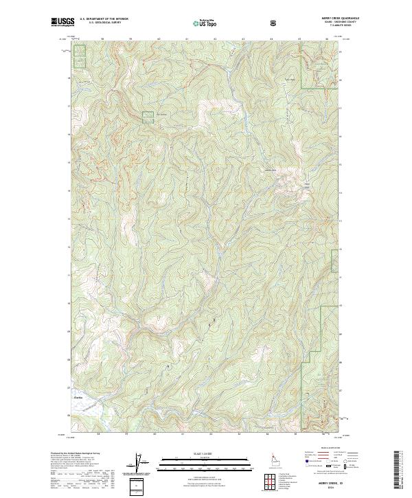
2024 Map of Merry Creek
USGS Topo · Published 2024About this map
Clarkia serves as the primary point of reference in this corner of the St. Joe National Forest, where the landscape is defined by the steep drainages of the Middle Fork Saint Maries River. The terrain is marked by numerous peaks and passes, including Swan Peak and Davies Pass, which oversee a network of forest roads and historical pathways. A notable landmark, The Incline, suggests the legacy of early logging or mining operations that relied on steep-grade transport in this part of Shoshone County. Numerous watercourses such as Lines Creek, Ashenfelter Creek, and Merry Creek carve through the forest, while the Dines Creek Historical Trl provides a physical connection to the era of early mountain transit. The dense network of OHV trails like the Merry Creek Ohv Trl indicates a transition from industrial use to recreational access within these national forest lands.
Find a feature on this map
48 named features on this map. Tap any name to fly to it.
Don’t see what you’re looking for? This feature index may not catch every label — zoom into the map to look around manually.
Map Details
Editions of this 2024 Merry Creek Map
This is the sole edition of this map. No revisions or reprints were ever made.
Other maps of this area

1955 · Pullman
USGS Topo · 1:250,000

1955 · Spokane
USGS Topo · 1:250,000

1958 · Spokane
USGS Topo · 1:250,000

1958 · Pullman
USGS Topo · 1:250,000

1961 · Fernwood
USGS Topo · 1:62,500

1961 · Bovill
USGS Topo · 1:62,500

1969 · Marble Mountain
USGS Topo · 1:24,000

1969 · Anthony Peak
USGS Topo · 1:24,000

1969 · Grandmother Mtn
USGS Topo · 1:24,000
1969 · Grice Ridge
USGS Topo · 1:24,000