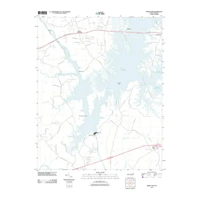
2010 Map of Merry Oaks
USGS Topo · Published 2010About this map
B Everett Jordan Lake dominates this central North Carolina landscape, where the confluence of the Haw River and Deep River was transformed by massive hydraulic engineering. The map shows the intricate fingers of the reservoir reaching into valleys once defined by Windfall Branch and Stinking Creek, leaving landforms like Gunter-Harris Island surrounded by water. Engineering infrastructure is prominent, notably the B Everett Jordan Dam and the adjacent New Hope Dam.
Find a feature on this map
61 named features on this map. Tap any name to fly to it.
Don’t see what you’re looking for? This feature index may not catch every label — zoom into the map to look around manually.
Map Details
Editions of this 2010 Merry Oaks Map
This is the sole edition of this map. No revisions or reprints were ever made.
Other maps of this area

1943 · Durham South
USGS Topo · 1:62,500

1951 · Farrington
USGS Topo · 1:24,000

1951 · Durham South
USGS Topo · 1:62,500

1953 · Raleigh
USGS Topo · 1:250,000

1954 · Raleigh
USGS Topo · 1:250,000

1968 · Bynum
USGS Topo · 1:24,000

1969 · New Hope Dam
USGS Topo · 1:24,000

1970 · Pittsboro
USGS Topo · 1:24,000

1970 · Colon
USGS Topo · 1:24,000

1970 · Moncure
USGS Topo · 1:24,000