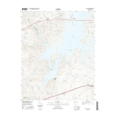
2016 Map of Merry Oaks
USGS Topo · Published 2016About this map
B Everett Jordan Lake dominates the central geography of this Chatham County landscape, its broad waters submerging former valley floors while leaving landmarks like Gunter-Harris Island and several bridge crossings to mark the older terrain. Near the southern edge, the Haw River flows toward its confluence, passing the established communities of Moncure and Merry Oaks. The settlement pattern is characterized by scattered crossroads and growing lakeside residential developments, with older sites like Griffins Crossroads, Seaforth, and Wilsonville serving as focal points for local history. The map records a modern transition where rural road networks, including Henry Webster Rd and Mount Gilead Church Rd, meet the expansive recreation-focused geography of the reservoir, illustrating how the damming of the river reshaped the local infrastructure and community layout.
Find a feature on this map
92 named features on this map. Tap any name to fly to it.
Don’t see what you’re looking for? This feature index may not catch every label — zoom into the map to look around manually.
Map Details
Editions of this 2016 Merry Oaks Map
This is the sole edition of this map. No revisions or reprints were ever made.
Other maps of this area

1943 · Durham South
USGS Topo · 1:62,500

1951 · Farrington
USGS Topo · 1:24,000

1951 · Durham South
USGS Topo · 1:62,500

1953 · Raleigh
USGS Topo · 1:250,000

1954 · Raleigh
USGS Topo · 1:250,000

1968 · Bynum
USGS Topo · 1:24,000

1969 · New Hope Dam
USGS Topo · 1:24,000

1970 · Pittsboro
USGS Topo · 1:24,000

1970 · Colon
USGS Topo · 1:24,000

1970 · Moncure
USGS Topo · 1:24,000