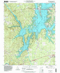
1993 Map of Merry Oaks
USGS Topo · Published 1999About this map
B. Everett Jordan Lake and the Jordan Lake State Recreation Area dominate this landscape where the Haw River and New Hope River converge. The creation of the reservoir altered the local topography, inundating much of the river valley and creating a complex network of peninsulas and inlets that define the modern geography. Despite these large-scale changes, the map preserves the location of longstanding rural landmarks and small crossroads communities.
Find a feature on this map
24 named features on this map. Tap any name to fly to it.
Don’t see what you’re looking for? This feature index may not catch every label — zoom into the map to look around manually.
Map Details
Editions of this 1993 Merry Oaks Map
This is the sole edition of this map. No revisions or reprints were ever made.
Other maps of this area

1943 · Durham South
USGS Topo · 1:62,500

1951 · Farrington
USGS Topo · 1:24,000

1951 · Durham South
USGS Topo · 1:62,500

1953 · Raleigh
USGS Topo · 1:250,000

1954 · Raleigh
USGS Topo · 1:250,000

1968 · Bynum
USGS Topo · 1:24,000

1969 · New Hope Dam
USGS Topo · 1:24,000

1970 · Pittsboro
USGS Topo · 1:24,000

1970 · Colon
USGS Topo · 1:24,000

1970 · Moncure
USGS Topo · 1:24,000