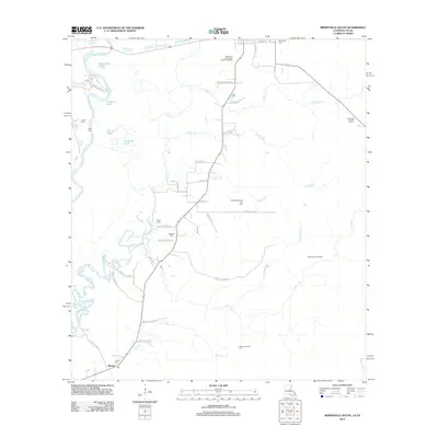
2012 Map of Merryville South
USGS Topo · Published 2012About this map
The Sabine River snakes along the western edge of this Beauregard Parish landscape, defining the boundary with Texas and creating a complex system of oxbows and backwaters like Horseshoe Lake and Dragover Lake. This 2012 survey illustrates a region where the extraction industry and local family history are deeply intertwined. The namesake Bivens Oil Field, along with its northern and northwestern extensions, dominates the southern and central terrain, serviced by a network of specialized routes like Bivens Oil Field Rd.
Find a feature on this map
54 named features on this map. Tap any name to fly to it.
Don’t see what you’re looking for? This feature index may not catch every label — zoom into the map to look around manually.
Map Details
Editions of this 2012 Merryville South Map
This is the sole edition of this map. No revisions or reprints were ever made.
Other maps of this area

1935 · Wilson Lake
USGS Topo · 1:31,680

1946 · Merryville
USGS Topo · 1:31,680

1947 · Singer
USGS Topo · 1:31,680

1947 · Pujo
USGS Topo · 1:31,680

1947 · Oretta
USGS Topo · 1:31,680

1947 · Wilson Lake
USGS Topo · 1:31,680

1947 · Hyatt
USGS Topo · 1:31,680

1947 · Bivens
USGS Topo · 1:31,680

1949 · Bancroft
USGS Topo · 1:31,680

1952 · Lake Charles
USGS Topo · 1:250,000