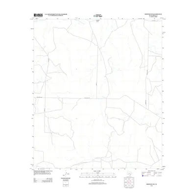
2012 Map of Mertzon SW
USGS Topo · Published 2012About this map
Wallace Draw and Lopez Cr carve seasonal drainage paths through this portion of Irion County, defining the hydrology of a landscape primarily structured for ranching. A network of rural arteries, including Ranch Road 2469 and named local routes such as Andy Suggs Rd and Mary's Rd, provide access to the large pastoral holdings typical of West Texas. The sparse distribution of named roads like Hargrave Rd and the presence of several numbered county roads, including Co Rd 410 and Co Rd 412, suggest a region where land use is consolidated and topography dictates the placement of infrastructure. This map reflects the enduring rural character of the Edwards Plateau region, where the intersection of low-lying draws and long-established ranch roads supports a quiet agricultural economy.
Find a feature on this map
8 named features on this map. Tap any name to fly to it.
Don’t see what you’re looking for? This feature index may not catch every label — zoom into the map to look around manually.
Map Details
Editions of this 2012 Mertzon SW Map
This is the sole edition of this map. No revisions or reprints were ever made.
Other maps of this area

1895 · Sherwood
USGS Topo · 1:125,000

1920 · Barnhart
USGS Topo · 1:62,500

1921 · Ketchum Mountain
USGS Topo · 1:62,500

1922 · Barnhart
USGS Topo · 1:62,500

1923 · Ketchum Mountain
USGS Topo · 1:62,500

1954 · San Angelo
USGS Topo · 1:250,000

1958 · San Angelo
USGS Topo · 1:250,000

1965 · San Angelo
USGS Topo · 1:250,000

1971 · Noelke
USGS Topo · 1:24,000
1971 · Barnhart NE
USGS Topo · 1:24,000