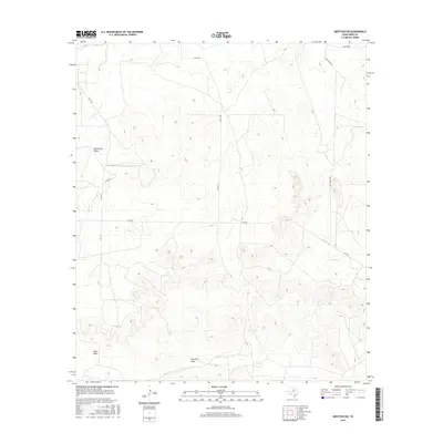
2016 Map of Mertzon SW
USGS Topo · Published 2016About this map
Big Hollow Draw and several other ephemeral drainages carve through this section of the Edwards Plateau in southwest Irion County. The landscape is defined by its complex topography, where deeply incised valleys like Rock Pen Draw and Seep Draw reveal a rugged ranching environment. Transportation in this arid region is sparse, consisting primarily of county roads and farm-to-market routes such as Fm 2469. These roads often follow the natural contours of the land or cut directly across the high divides between watercourses. In the eastern portion of the map, Lopez Cr provides a primary drainage point, while named ranch roads like Andy Suggs Rd and Shay Rd suggest the localized importance of specific landholdings and family-named access points in this rural West Texas expanse.
Find a feature on this map
11 named features on this map. Tap any name to fly to it.
Don’t see what you’re looking for? This feature index may not catch every label — zoom into the map to look around manually.
Map Details
Editions of this 2016 Mertzon SW Map
This is the sole edition of this map. No revisions or reprints were ever made.
Other maps of this area

1895 · Sherwood
USGS Topo · 1:125,000

1920 · Barnhart
USGS Topo · 1:62,500

1921 · Ketchum Mountain
USGS Topo · 1:62,500

1922 · Barnhart
USGS Topo · 1:62,500

1923 · Ketchum Mountain
USGS Topo · 1:62,500

1954 · San Angelo
USGS Topo · 1:250,000

1958 · San Angelo
USGS Topo · 1:250,000

1965 · San Angelo
USGS Topo · 1:250,000

1971 · Noelke
USGS Topo · 1:24,000
1971 · Barnhart NE
USGS Topo · 1:24,000