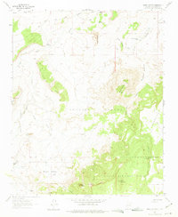
1961 Map of Mesa Cortada
USGS Topo · Published 1975About this map
Cibola National Forest encompasses the high country of this Northwestern New Mexico landscape, characterized by dramatic plateaus and deeply cut arroyos. The map reveals a land of intermittent water sources and traditional ranching, where remote sites like Rancho de la Punta and Michael Ranch suggest the historical human footprint in an arid environment. Navigating the terrain relies on named tanks and springs, such as Gonzolas Tank and Ojo Navajo, which provided essential water for livestock and travel.
Find a feature on this map
62 named features on this map. Tap any name to fly to it.
Don’t see what you’re looking for? This feature index may not catch every label — zoom into the map to look around manually.
Map Details
Editions of this 1961 Mesa Cortada Map
3 editions found
Other maps of this area

1883 · Mt. Taylor
USGS Topo · 1:250,000

1886 · Mt. Taylor
USGS Topo · 1:250,000

1892 · Mt. Taylor
USGS Topo · 1:250,000

1899 · Mt. Taylor
USGS Topo · 1:250,000

1958 · Albuquerque
USGS Topo · 1:250,000

1961 · El Dado
USGS Topo · 1:24,000

1961 · Cerro Parido
USGS Topo · 1:24,000

1961 · El Dado Mesa
USGS Topo · 1:24,000

1961 · Mesita Del Gavilan
USGS Topo · 1:24,000
1961 · Mesita Americana
USGS Topo · 1:24,000