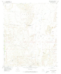
1959 Map of Mesa Del Yeso
USGS Topo · Published 1974About this map
Puertecito of Bowling Green sits at a geographic crossroads within the arid landscape of central New Mexico, where land-grant history meets the complex drainage systems of the Rio Grande valley. This 1959 survey documents the transition from established ranching sites like Old Stapleton Ranch and Sabino Ranch to a landscape marked by numerous ruins and scattered prospect workings. The terrain is defined by dramatic mesas and canyon systems, most notably the Mesa del Yeso and the wide Valle de Ojo de la Parida. The prominence of the Sevilleta Grant Boundary indicates the enduring legacy of Spanish and Mexican land grants in shaping property and usage in the region. Hydrology is central to the area's layout, with intricate watercourses like Arroyo Alamillo and Cañoncito de la Uva carving through the dry earth.
Find a feature on this map
26 named features on this map. Tap any name to fly to it.
Don’t see what you’re looking for? This feature index may not catch every label — zoom into the map to look around manually.
Map Details
Editions of this 1959 Mesa Del Yeso Map
3 editions found
Other maps of this area

1906 · Socorro
USGS Topo · 1:62,500

1916 · La Joya
USGS Topo · 1:125,000

1952 · San Anacia
USGS Topo · 1:24,000

1952 · La Joya
USGS Topo · 1:24,000

1952 · Becker SW
USGS Topo · 1:24,000

1954 · Socorro
USGS Topo · 1:250,000

1958 · Socorro
USGS Topo · 1:250,000

1959 · Loma De Las Canas
USGS Topo · 1:24,000

1959 · Socorro
USGS Topo · 1:24,000

1959 · Mesa Del Yeso
USGS Topo · 1:24,000