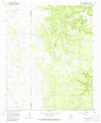
1966 Map of Mesa El Toro
USGS Topo · Published 1986About this map
Mesa El Toro and the surrounding high country define this portion of the New Mexico landscape during the mid-1960s. The terrain is characterized by a network of drainage features and livestock infrastructure, straddling the border between Santa Fe and San Miguel counties. Water management is central to the area's utility, evidenced by a string of numbered reservoirs including Tank No. 1 through Tank No. 3, alongside named sources like Mesa Well and Red Tank.
Find a feature on this map
19 named features on this map. Tap any name to fly to it.
Don’t see what you’re looking for? This feature index may not catch every label — zoom into the map to look around manually.
Map Details
Editions of this 1966 Mesa El Toro Map
2 editions found
Other maps of this area

1894 · Lamy
USGS Topo · 1:125,000

1954 · Santa Fe
USGS Topo · 1:250,000

1958 · Santa Fe
USGS Topo · 1:250,000

1960 · Stanley
USGS Topo · 1:62,500
1966 · El Cabo
USGS Topo · 1:24,000
1966 · Mesa El Toro
USGS Topo · 1:24,000
1966 · Clines Corners
USGS Topo · 1:24,000
1966 · Laguna Ortiz
USGS Topo · 1:24,000
1966 · Rencona
USGS Topo · 1:24,000
1966 · Leyba
USGS Topo · 1:24,000