
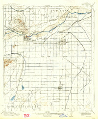
1915 Map of Mesa
USGS Topo · Published 1915About this map
The Salt River corridor dominates this desert landscape, revealing a sophisticated early 20th-century irrigation network essential for the valley's agricultural growth. The interconnected system of the Consolidated Canal, Crosscut Canal, and Utah Canal defines the development patterns of early Mesa and Tempe. Educational and institutional foundations are prominent, ranging from the Arizona State Normal School to rural landmarks like the Rohrig School and Kyrene School.
Find a feature on this map
54 named features on this map. Tap any name to fly to it.
Don’t see what you’re looking for? This feature index may not catch every label — zoom into the map to look around manually.
Map Details
Editions of this 1915 Mesa Map
2 editions found
Other maps of this area

1904 · Camelback
USGS Topo · 1:62,500

1904 · Desert Well
USGS Topo · 1:62,500

1904 · Ft. McDowell
USGS Topo · 1:62,500

1906 · Camelsback
USGS Topo · 1:62,500

1906 · Ft. McDowell
USGS Topo · 1:62,500

1906 · Desert Well
USGS Topo · 1:62,500

1907 · Sacaton
USGS Topo · 1:62,500

1912 · Phoenix
USGS Topo · 1:62,500

1913 · Mesa
USGS Topo · 1:62,500

1913 · Maricopa
USGS Topo · 1:62,500