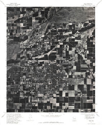
1971 Map of Mesa
USGS Topo · Published 1987About this map
Mesa appears as an expanding suburban grid in this 1971 orthophoto, where dense residential developments meet the sharp edges of remaining agricultural fields. This aerial mosaic, published by the U.S. Geological Survey, captures a transitional moment for the community as it grows southward from the wide, braided bed of the Salt River. The imagery reveals the stark geometry of the desert landscape, defined by a complex network of irrigation canals and section-line roads that shaped the valley's settlement. To the north, the riverbed shows the characteristic sand bars and scrub of the arid drainage system, while the central portions of the map document the rapid conversion of citrus groves and cotton fields into the structured neighborhood blocks of a modern city.
Find a feature on this map
2 named features on this map. Tap any name to fly to it.
Don’t see what you’re looking for? This feature index may not catch every label — zoom into the map to look around manually.
Map Details
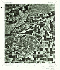
Editions of this 1971 Mesa Map
2 editions found
Other maps of this area

1904 · Camelback
USGS Topo · 1:62,500

1904 · Desert Well
USGS Topo · 1:62,500

1904 · Ft. McDowell
USGS Topo · 1:62,500

1906 · Camelsback
USGS Topo · 1:62,500

1906 · Ft. McDowell
USGS Topo · 1:62,500

1906 · Desert Well
USGS Topo · 1:62,500

1913 · Mesa
USGS Topo · 1:62,500

1915 · Mesa
USGS Topo · 1:62,500

1930 · Cave Creek
USGS Topo · 1:125,000

1939 · Cave Creek
USGS Topo · 1:125,000