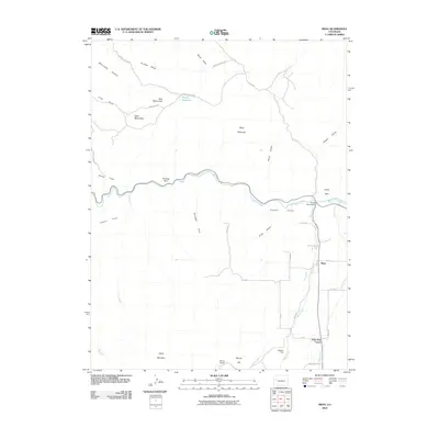
2010 Map of Mesa
USGS Topo · Published 2010About this map
Plateau Valley serves as the central corridor of this Western Slope landscape, where the waters of Plateau Creek are fed by numerous descending drainages like Shire Gulch and King Gulch. The settlement of Mesa is the primary hub, situated near the junction of Mesa Creek and Tate Creek. To the south, John Held Corner and the Morris Ranch mark the transition toward the higher elevations of Chalk Mountain and Barney Hill.
Find a feature on this map
44 named features on this map. Tap any name to fly to it.
Don’t see what you’re looking for? This feature index may not catch every label — zoom into the map to look around manually.
Map Details
Editions of this 2010 Mesa Map
This is the sole edition of this map. No revisions or reprints were ever made.
Other maps of this area

1929 · Grand Valley
USGS Topo · 1:62,500

1929 · Roan Creek
USGS Topo · 1:62,500

1955 · Cameo
USGS Topo · 1:24,000

1955 · Mesa
USGS Topo · 1:24,000

1955 · Molina
USGS Topo · 1:24,000

1955 · Skyway
USGS Topo · 1:24,000

1956 · Grand Junction
USGS Topo · 1:250,000

1959 · Grand Junction
USGS Topo · 1:250,000

1960 · Grand Junction
USGS Topo · 1:250,000

1962 · Grand Junction
USGS Topo · 1:250,000