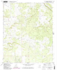
1971 Map of Mesa Redonda NW
USGS Topo · Published 1984About this map
The arid landscape of Navajo County unfolds across this 1971 survey, showing a transition from the lower plains of Concho Flat Wash up to the prominent elevated plateau of Black Mesa. Water management defines the human activity in this high desert terrain, anchored by The Canal in the west and scattered water sources like Guys Well and North Gate Well to the south. The topographic detail highlights a complex drainage system where ephemeral channels such as Hatch Draw and Hay Hollow carve into the mesa slopes.
Find a feature on this map
13 named features on this map. Tap any name to fly to it.
Don’t see what you’re looking for? This feature index may not catch every label — zoom into the map to look around manually.
Map Details
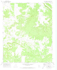
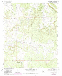
Editions of this 1971 Mesa Redonda NW Map
3 editions found
Other maps of this area

1886 · St Johns
USGS Topo · 1:250,000

1886 · Holbrook
USGS Topo · 1:250,000

1892 · St Johns
USGS Topo · 1:250,000

1893 · Holbrook
USGS Topo · 1:250,000

1954 · Holbrook
USGS Topo · 1:250,000

1954 · Saint Johns
USGS Topo · 1:250,000

1955 · Adamana 3 SE
USGS Topo · 1:24,000

1957 · Holbrook
USGS Topo · 1:250,000

1957 · Saint Johns
USGS Topo · 1:250,000

1958 · Saint Johns
USGS Topo · 1:250,000